Innovative Surveyors who make a difference by enabling safety on site
--
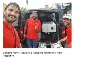
MONITOR THE PLANET
SURVEYING / MONITORING
Espandi barra di navigazione
Menu
Services
Business Sectors
Tecnology and Software
Geosolvo
blog
Careers
Italiano
Inglese
Italiano
Inglese
Home
blog
Topographic surveying
20 km mobile mapping data acquisition of a cycle path near Ravenna.
24 June 2024
Mobile Mapping data acquisition of 20 km of a cycleway that runs in historic urban areas and nonurban areas
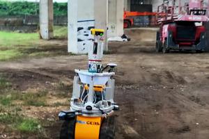
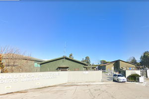
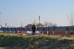
Topographic site assistance thermoelectric power plant
18 March 2024
Control and stackout activities of concrete structure, metallic structures and turbine placement.
Over 100 km of motorway detected and calculated in Milan
01 February 2024
Verification and integration of the mapping of highways n. A52 and A51 with the help of Geosolvo Solutions®
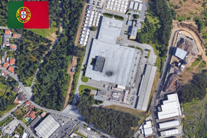
Survey of a Portuguese winery using a three-dimensional laser scanner
07 September 2023
Direct point cloud acquisition
Topographical tracings of warehouses
16 July 2023
Traced 3 construction sites in Northern Italy for a multinational corporate
Surveying of construction sites
14 March 2023
Technical consulting services and tracing activities
Topographical surveys river belt
08 February 2023
Three-dimensional measurements for preparation hydrological-hydraulic study of a watercourse
Surveys and Monitoring in BBT tunnels
03 February 2023
Topographic services for the construction of the BBT tunnel in Austria
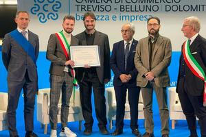
1st prize: Social Innovation and Sustainable Development
11 November 2022
The Treviso-Belluno Chamber of Commerce delivers the first prize to Monitor the Planet!
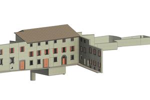
Laser scanning 3D survey - metal building
09 November 2022
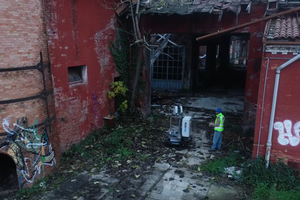
Assistance and surveying to the structural works management in a civil masonry building reinforcement intervention.
External survey of military airport
13 September 2022
Plano Altimetric laser scanner measurements
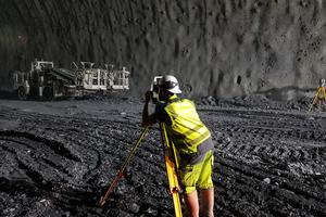
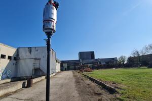
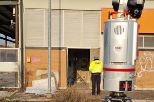
3D Laser Scanner in Thermoelectric Power Station in Turbigo (MI)
03 July 2022
2 km of the Combined Cycle Power Plant’s reticular beam were detected for the realization of new project.
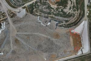
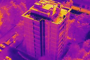
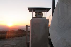
Thermographic inspection of the landfill
16 June 2022
Survey with drone and thermal camera
Survey of a condominium on Lake Como
03 June 2022
Activities with internal and external laser scanner instrumentation
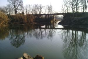
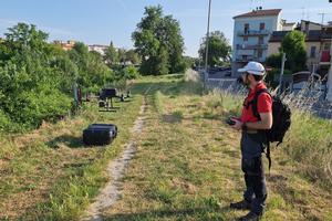
Survey of the Lamone River
15 May 2022
Water course surveyed in Faenza
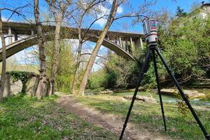
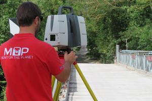
Survey bridge Casola Val Senio (RA)
04 April 2022
Carried out survey of structural geometry of the artifact
3D external and internal survey of an industrial factory
31 March 2022
Three-dimensional survey of buildings
Monitor the Planet is running a project to support the Climate Adaptation Strategy
10 March 2022
Despite of the hard scenario these days, the team has shown great resilience and has been able to react by focusing on product innovation
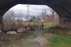
Surveys of former rest areas and related underpasses
03 February 2022
Surveyed lay-bys of A7 - A50 - A51 - A52 highways
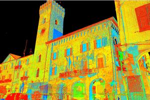
Color survey of building
25 January 2022
Acquisition of topographical data for Superbonus contribution 110%.
Geophysical survey of the subsoil in Ravenna
18 January 2022
Georadar and topographic survey for tank indentation
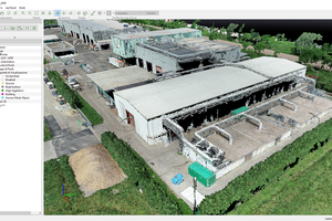
3D survey industrial building and surrounding area
12 January 2022
Laser scanner scanning in Mantua
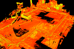
5700 scans 3D laser scanner of Ministry of Defence's real estates
13 December 2021
Seismic tests through the creation of a laser scanner model. We used: 5 laser scanners + 1 drone RTK + 8 tripods + 1 MecGeos
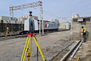
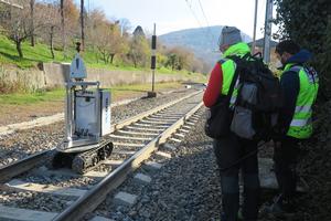
Geometric survey of track section
04 November 2021
Detailed verification in the railway field
Surveys 3D of Luxury Hotel
20 October 2021
Surveyed two important hotels in Caserta (CE)
Condominium complex survey
12 October 2021
Acquired about 12.000 mq of data in a single day
Thermographic survey of the condominium
28 September 2021
Building surveyed by infrared camera
Plano-altimetric surveys and bathymetry on the Tanaro river
20 September 2021
Surveyed 25 kilometers of the second river of Piedmont
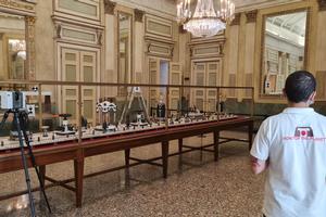
Survey of the Centerpiece by Giacomo Raffaelli
14 September 2021
Surveyed classic monuments of the Royal Palace of Milan
Survey of primitive historical finds
08 September 2021
Some works of the Archaeological Museum of Acqui Terme surveyed
8000-year-old artifact survey
27 August 2021
Ancient Piroga of the Museum of inland navigation detected
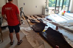
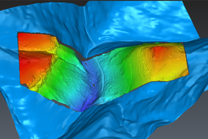
3D survey of a masonry arch bridge
02 August 2021
Surveyed the structure located below the Bailey Bridge in Faenza (RA)
Drone LIDAR survey with topographic support
09 July 2021
Surveyed Corso (VR) campaign area
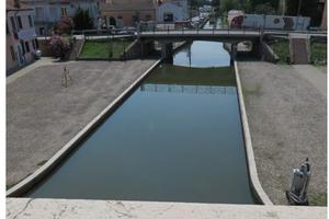
Topographical monitoring of docks
24 June 2021
Monitoring of channel banks in the centre of Comacchio (FE)
House survey in the historic center
10 May 2021
Internal and external survey of the building
Georadar and Magnetometric surveys
16 April 2021
Survey of the subsoil by high frequency instrumentation
Three-dimensional survey of work in metal carpentry
31 March 2021
Performed surveys for proper assembly verification
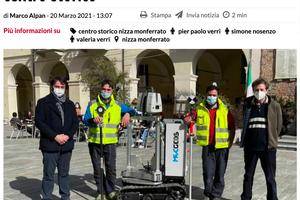
To redevelop UNESCO areas with 3D laser scanner
22 March 2021
This method is also useful for those involved in architecture, geomorphology and, more generally, the heritage of buildings in the historic center.
3D surveys for the drafting of Color Plan
01 March 2021
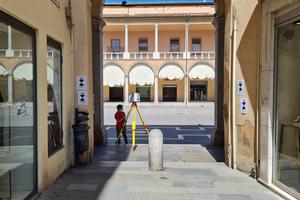
Topographic support surveys of the streets of the historical center of Nizza Monferrato (AT)
Geognostic and topographical investigations
16 February 2021
Surveys of the Pontelungo underground utility in Bologna (BO)
Monitor the Planet debuting at CES di Las Vegas.
07 January 2021
CES® 2021 Digital Venue - January 11-14, 2020 - Las Vegas (USA)
Topographic surveys for the new construction of a second railway line
18 December 2020
Three-dimensional and photogrammetric surveys in Pettenasco
Monitor the Planet chosen for the cover of ECONERRE
10 December 2020
Magazine of the Emilia-Romagna Chamber of Commerce
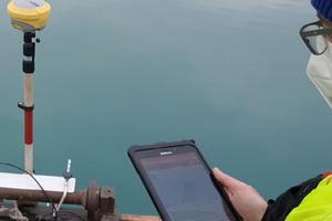
Bathymetric survey of an area of 107,000 sqm in Sandrigo
04 December 2020
Bathymetric survey and return of the three-dimensional model of the underside basin of the hollow floor
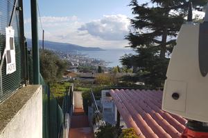
Periodic monitoring of active landslides
26 November 2020
Installation of integrated Geomos system and applications for remote movement visualization.
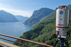
Three-dimensional Laser Scanner and aerophotogrammetric surveys in Sanremo e Bordighera
26 October 2020
Topographical surveys of single-family and multi-family buildings for the purpose of obtaining the Superbonus contribution 110%.
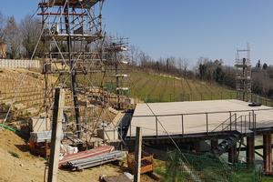
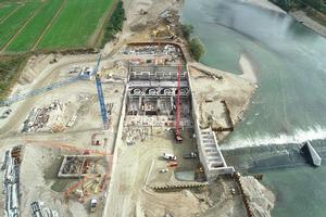
Topographical tracings - Hydroelectric power station on the river Po
01 September 2020
Topographic surveys and verifications of hydroelectric plants
Photogrammetric surveys of the Waste Centre
01 July 2020
Realization of laser scanner surveys and polygonal determination with photogrammetric surveys of the Waste Centre.
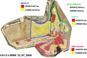
Survey and monitoring of the settlement and volume of tanks of a waste collection plant
04 May 2020
3D survey of the waste landfill area in order to monitor the data and compare them with historical data
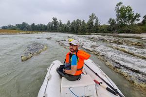
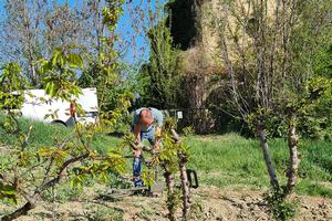
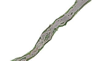
Surveys of Meduna Torrent's riverbed
09 March 2020
3D survey of 6km of riverbed to be inserted in historical series of surveys
1
(current)
2
»