01 March 2021
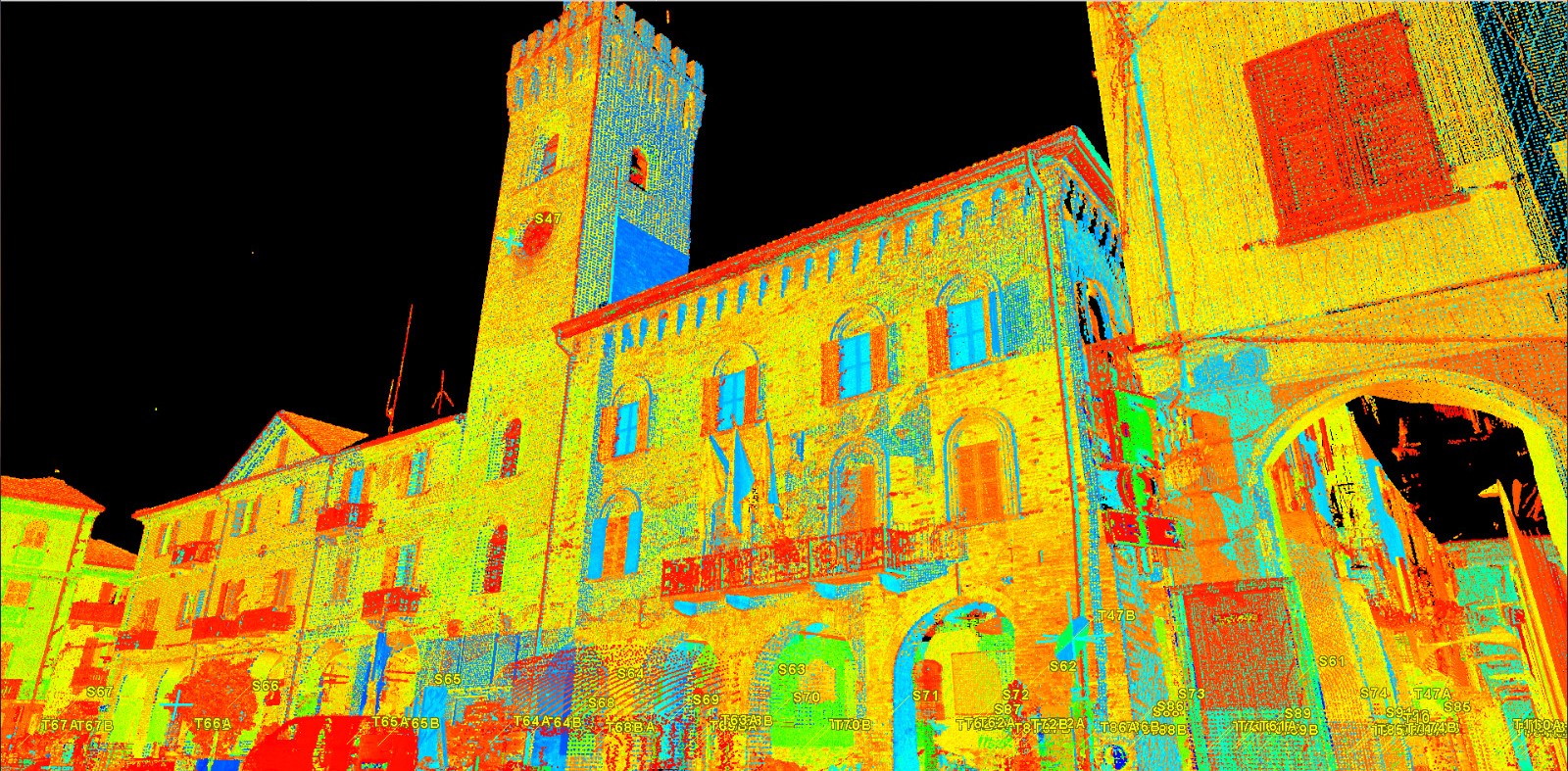
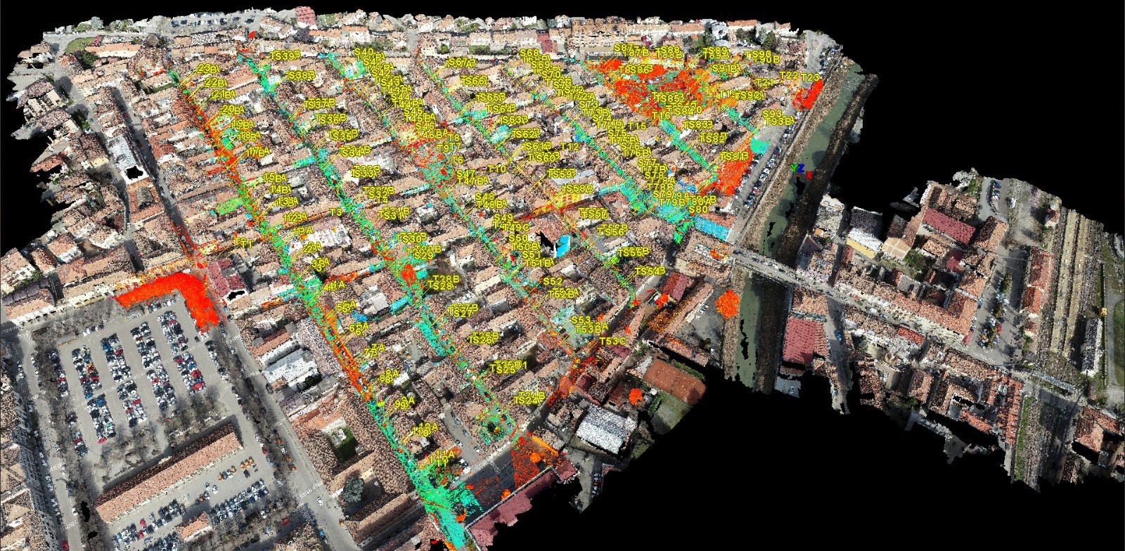
Three-dimensional Laser Scanner surveys were carried out of the street fronts of the buildings in the streets of Nizza Monferrato for the
safeguard the buildings of the
historic center. The purpose of the assignment was to survey
the elevations of the structures in order to allow the Municipality of Nizza Monferrato to apply the special urban planning tool (
Color Plan) with the aim of
preserving and improving the
color tones and
vertical planes of the city by implementing
restoration and/or redevelopment.
- Project: Surveys of Color
- Client: Municipality of Nizza Monferrato
- Place: Nizza Monferrato (AT)
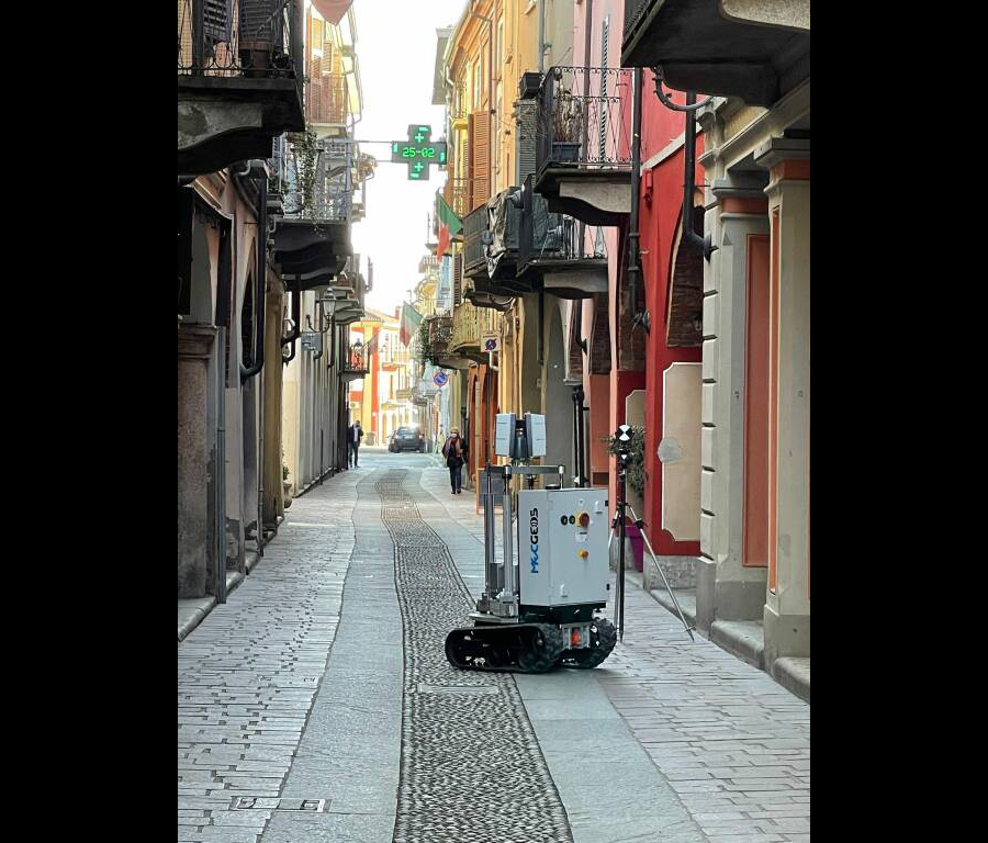
For the execution of the work was used the following instrumentation:
- MecGeos Remote Control
- TS60 Motorized TPS (0,5") Leica-Geosystems
- Laser Scanner P30 Leica-Geosystems
For the elaboration of the work the programs were used:
- Cyclone Leica Geosystems
- 3DReshaper Hexagon
Geosolvo®Solutions
- Self-driving APP
- Robot MecGeos V2 to automate 3D survey
Cloud Viewer link: tips for better viewing.
Click on button with the three setting lines:
- click on "Aspetto" and increase the points at full scale to the maximum
- look at "Progetto" and click on the "project name" and increase the point size scale
- look at "Progetto" and click on the "project name" and look at "Colore" you can see RGB selected by default. For non-color projects change "RGB" to "Gradiente di intensità"