18 December 2020
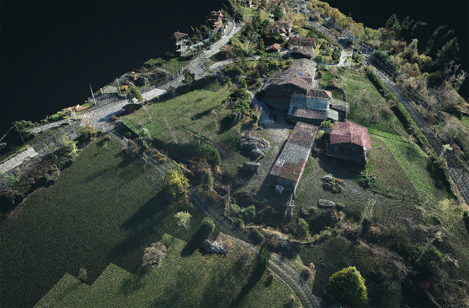
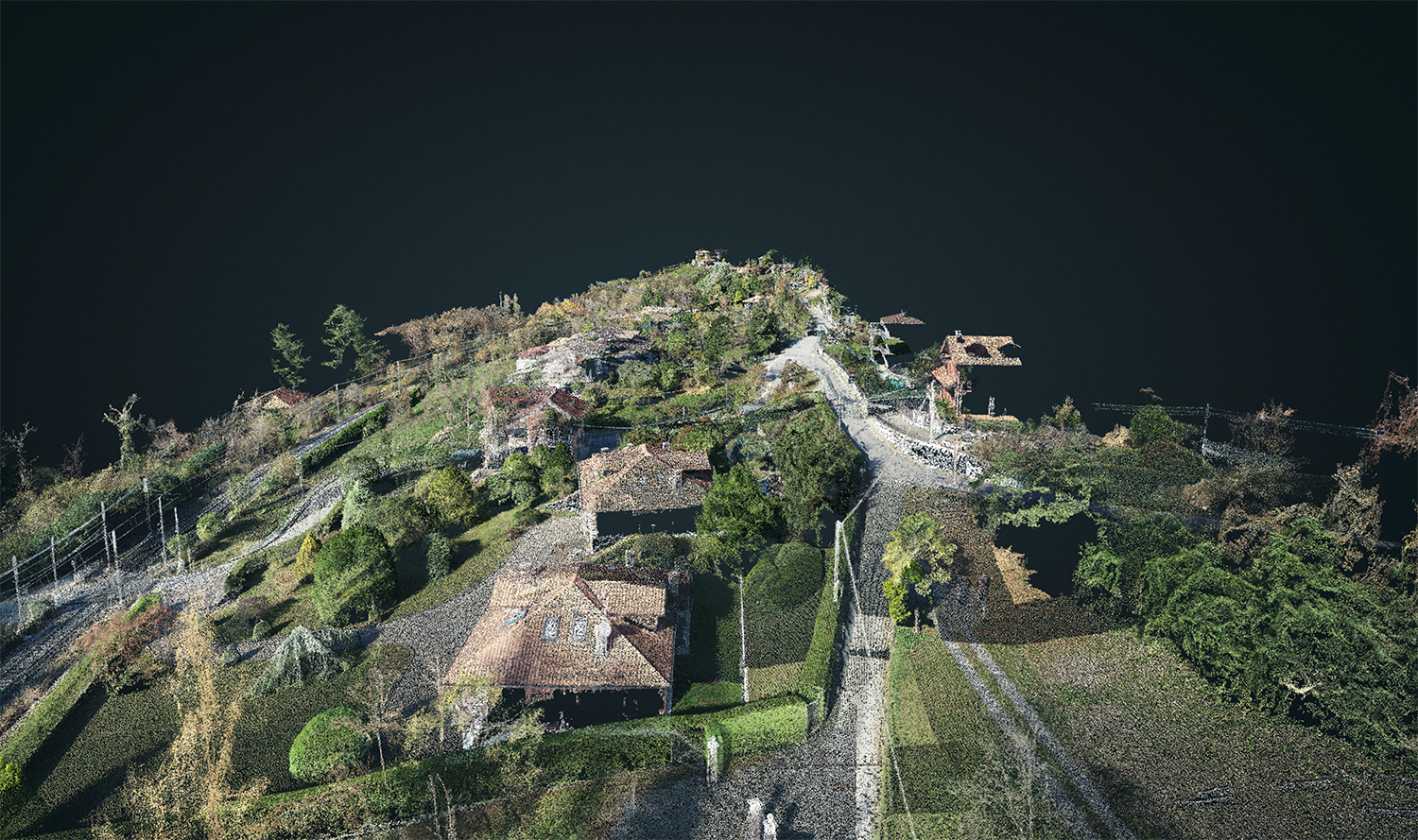
Laser Scanner scans and
geometrical modeling were carried out along the railway network of Alessandria-Arona and Vignale-Domossola for the
realization of a railway upgrading project commissioned by Rete Ferroviaria Italiana SPA (RFI).
The purpose of the assignment was to carry out
survey and
restitution of the state of fact of the
train tracks and parallel areas for a band of 50 meters in order to allow the designers to take note of the interferences and geometries present on site.
- Project: Rail surveys
- Client: Costruzione Linee Ferroviarie
- Place: Pettenasco (NO)
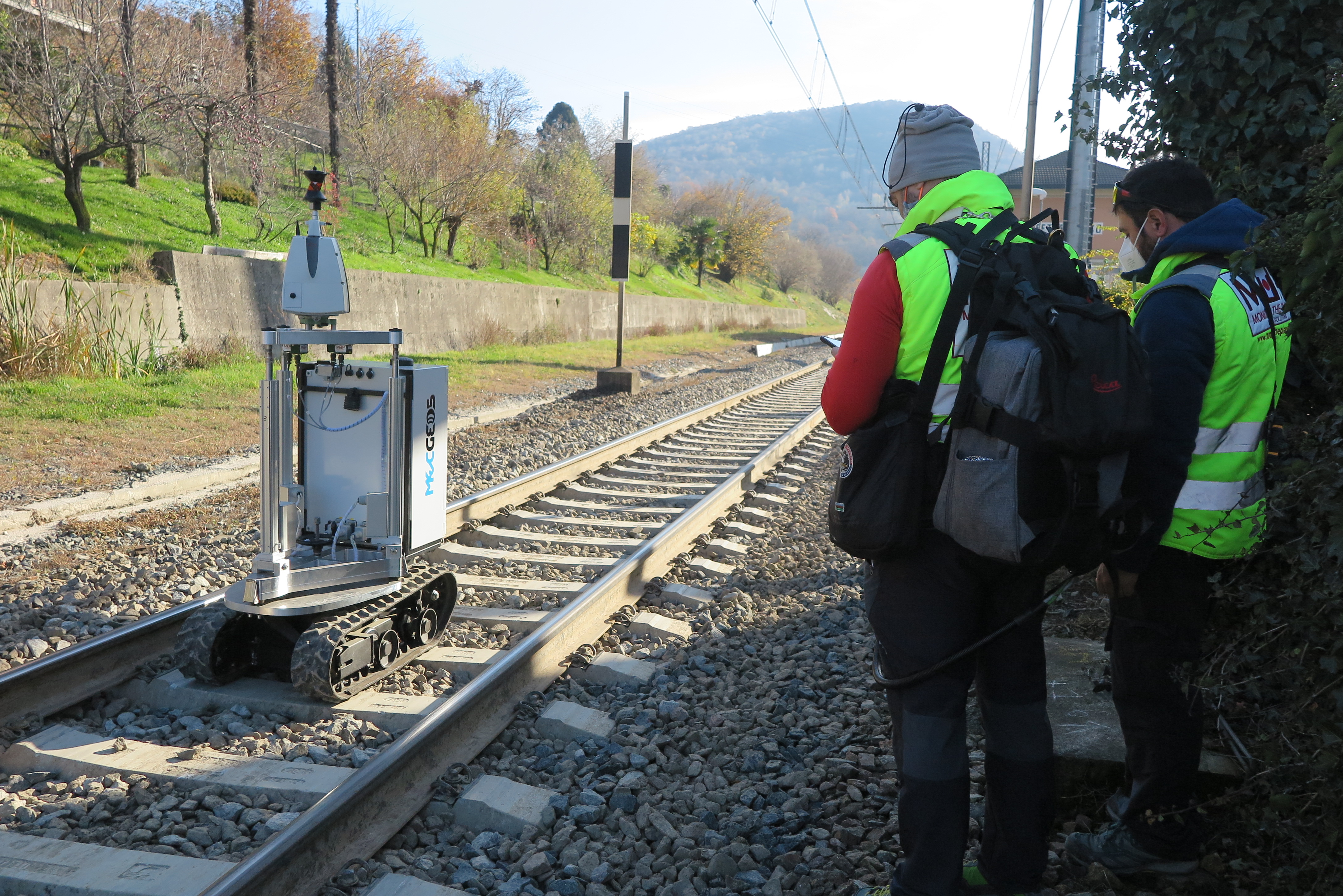
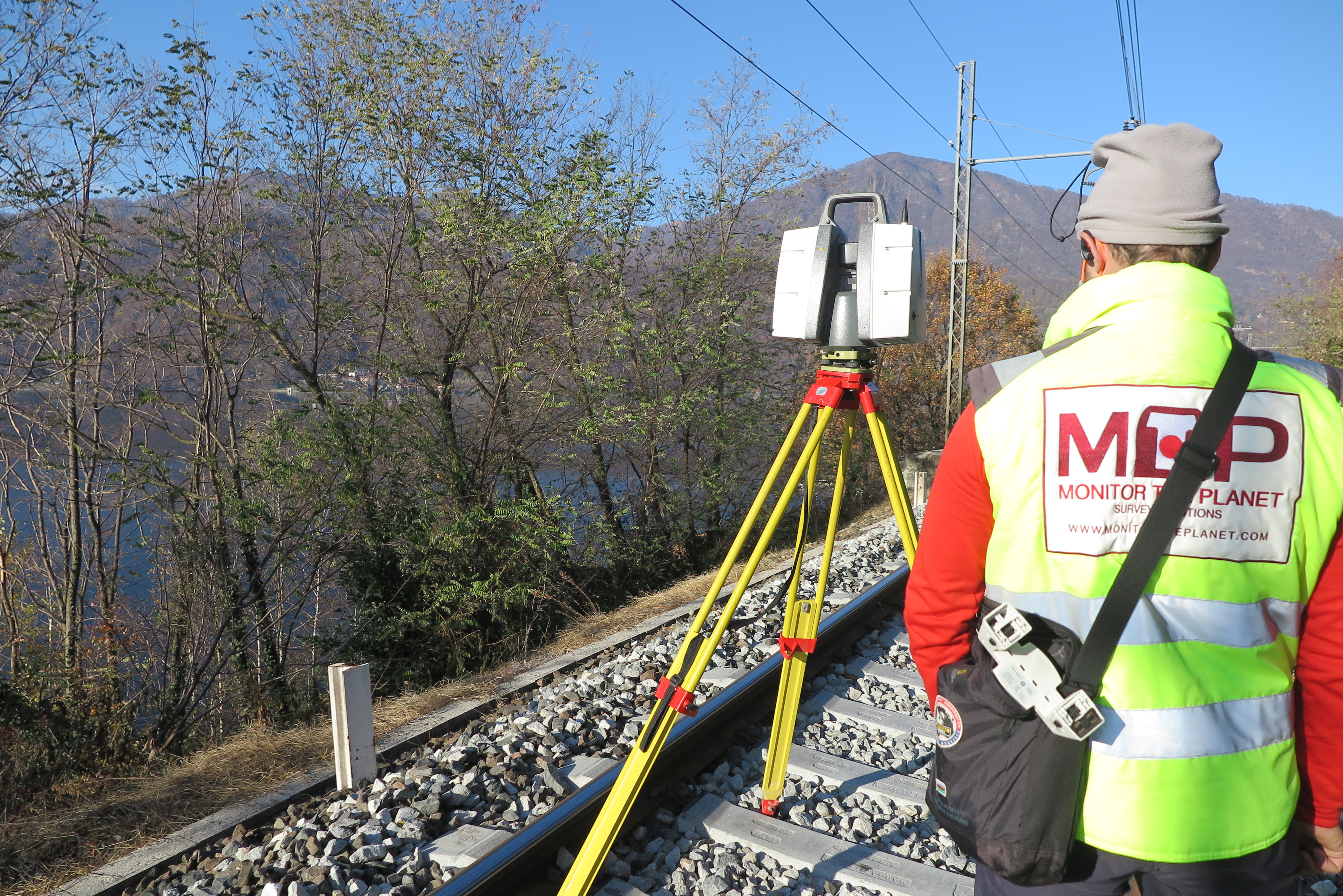
For the execution of the work was used the following instrumentation:
- MecGeos Remote Control
- TPS Motorized MS60 (0,5" - 1") Leica-Geosystems
- Laser Scanner P30 Leica-Geosystems
- GPS Zenith 40 e 35 Pro Geomax
- Drone Phantom4 RTK
For the elaboration of the work the programs were used:
- Cyclone Leica Geosystems
- 3DReshaper Hexagon
- Fusion Geomax
- Pix4D
Geosolvo®
- Solutions Self-driving APP
- Robot MecGeos V1 to automate 3D survey
Cloud Viewer link: tips for better viewing.
Click on button with the three setting lines:
- click on "Aspetto" and increase the points at full scale to the maximum
- look at "Progetto" and click on the "project name" and increase the point size scale
- look at "Progetto" and click on the "project name" and look at "Colore" you can see RGB selected by default. For non-color projects change "RGB" to "Gradiente di intensità"