14 March 2023
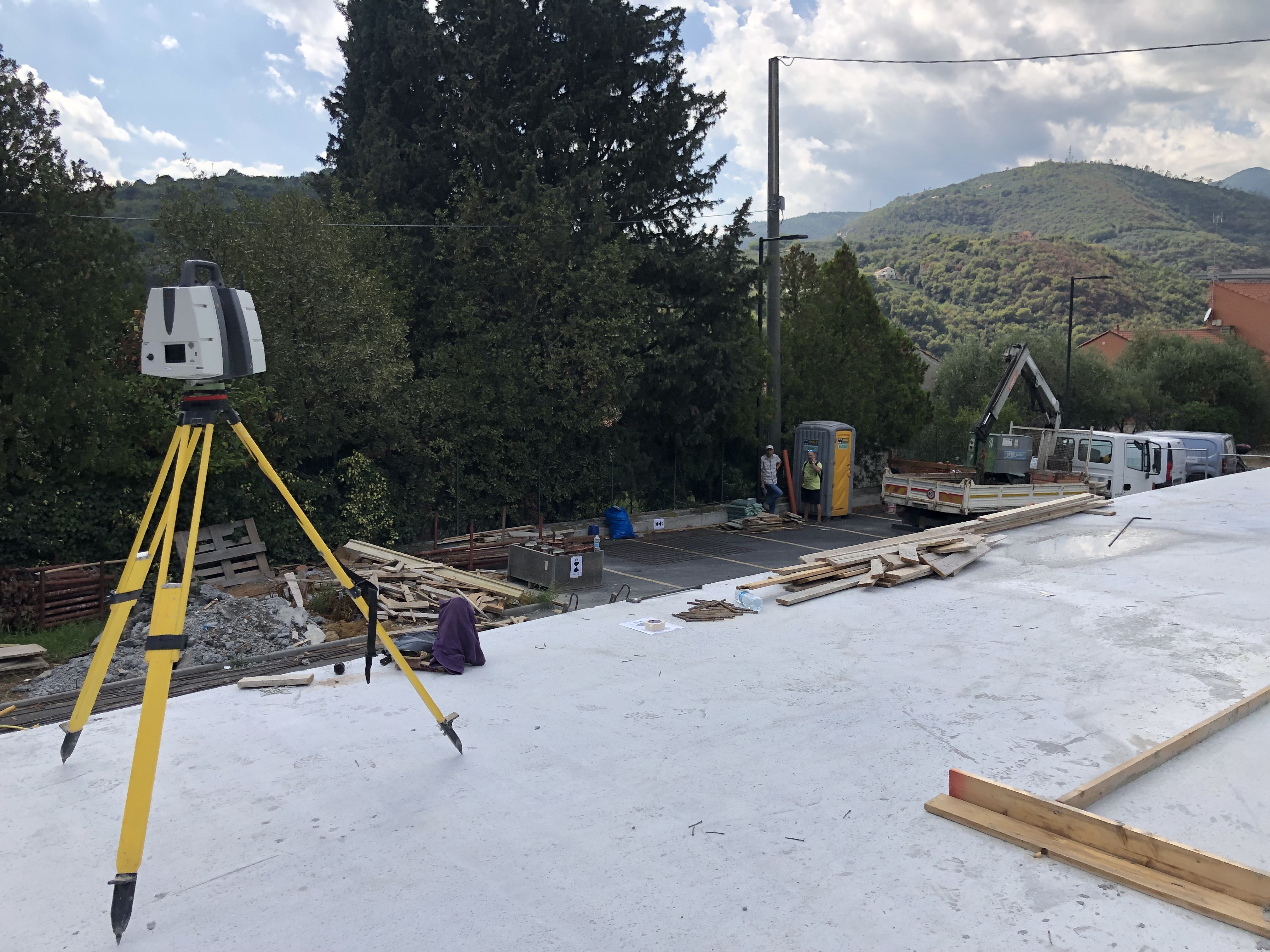
We carry out
topographic tracing for construction sites thanks to our expertise gained in the field of surveying and
the high-tech tools at our disposal.
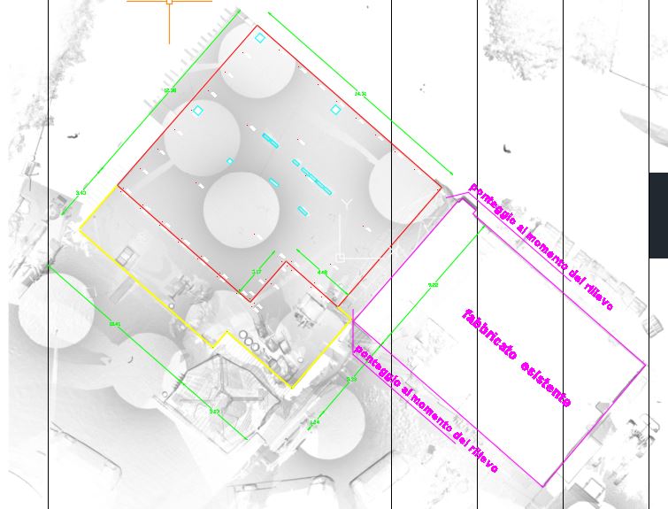
The purpose of the assignment is
to provide support to companies
during the construction and/or implementation of works by returning
2D models with the specific position of the points acquired and to support building design.
- Project: Tracings
- Client: Direct company
- Place: national territory
For the execution of the work was used the following instrumentation:
- Stazione totale RTC360 LeicaGeoSystems
- GPS
- Drone
- Laser Scanner
For the elaboration of the work the programs were used:
- Cyclone LeicaGeosystems
- Autocad