09 March 2020
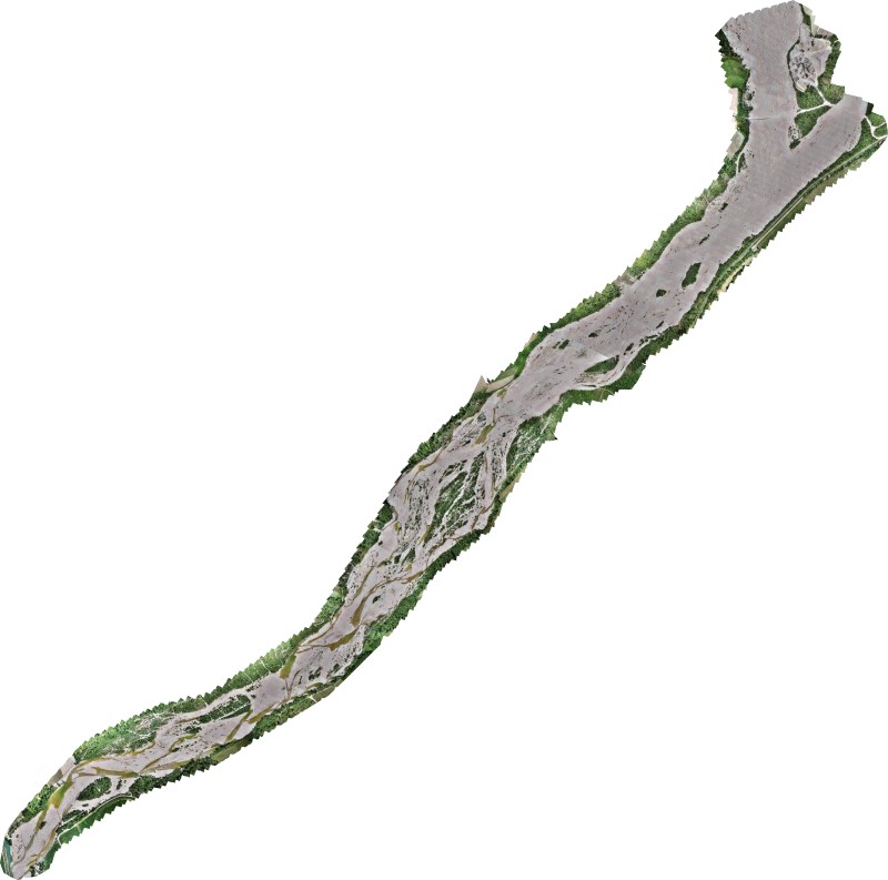
We performed
three-dimensional surveys to obtain a restitution of the
orthophoto data of the entire area of
River Management.
The purpose of the work is to
survey Meduna Torrent's
riverbed in order to insert and update the data stored in a historical archive (from 1996 to 2005)
- Project: Surveys and data processing of the hydraulic area
- Client: direct company
- Place: Zoppola e Cordenons (PN)
For the execution of the work was used the following instrumentation:
- DRONE: PHANTOM 4 RTK PRO
- GNSS: Geomax Zenit 35 Pro to support in order to survey areas difficult to trace with the use of the drone