04 December 2020
A
three-dimensional survey was carried out by
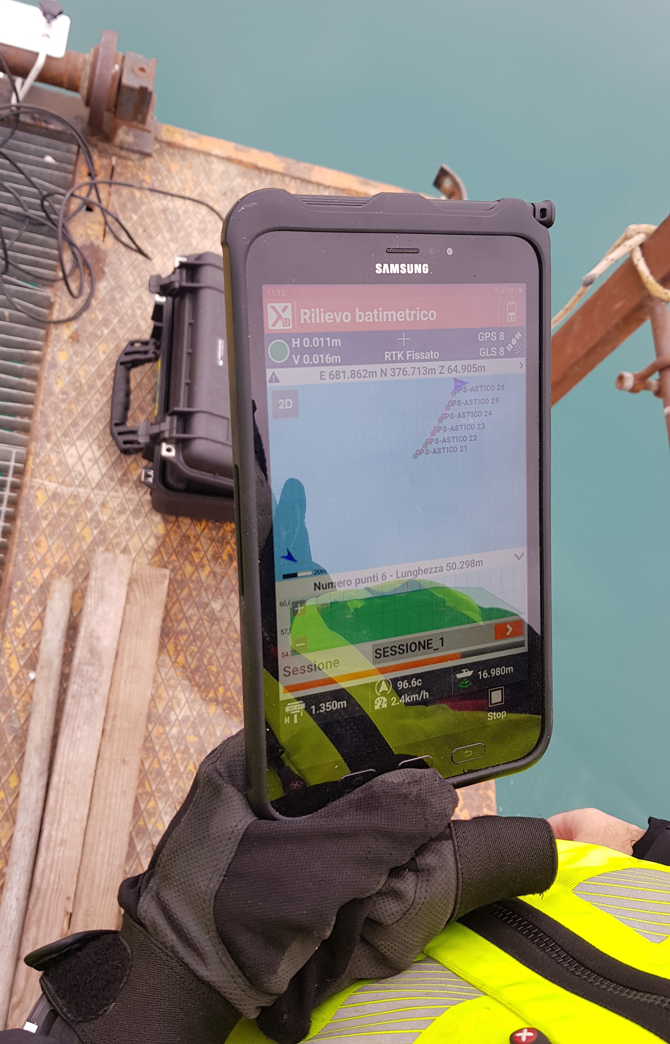
bathymetric survey using a motor dinghy equipped with a differential GPS receiver with RTK satellite correction, an active single beam echo sounder.
The purpose of the assignment was to extract the collected data and to
create a 3D model in the form of a 3D report and graphic documentation and
quoted plan in order to know the morphological course of the lake.
- Project: Basin bathymetry from extraction of furnace material
- Client: Direct company
- Place: Sandrigo (VI)
For the execution of the work was used the following instrumentation:
- GPS ZENITH 35 PRO GeoMax
- Batimetro Sonar Mite
For the elaboration of the work the programs have been used: