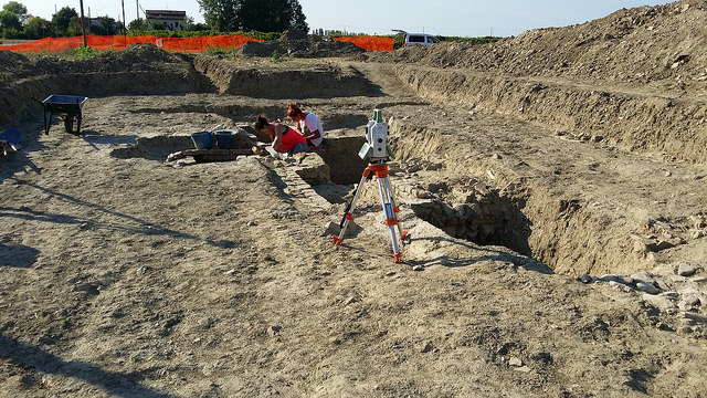
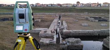
Through laser scanner technology, we are able to plan the process of recording, analyzing and storing data, proposing three-dimensional geo-referenced digital surveys that can be connected to specific databases that allow the creation of easily interrogated GIS processing.
We investigate the subsoil with technologies in the field of the non-visible to give evidence of underground presences of buildings or archaeological properties not yet discovered.
Through laser scanner technology, we are able to plan the process of recording, analyzing and storing data, proposing
three-dimensional geo-referenced digital surveys that can be connected to specific databases that allow the creation of easily interrogated GIS processing.
We investigate the subsoil with technologies in the
field of the non-visibleto give evidence of underground presences of buildings or archaeological properties not yet discovered. Our services include:
- Engineering surveys for future construction and expansion projects
- Legal surveys
- Industrial surveys
- Piping surveys
- Structural surveys
- Environmental monitoring
- Data acquisition
- Data storage and management
- Constraints mapping
- Visual impact assessment
- Applications development
- Aerial mapping and LiDAR data acquisition