MAKE LAND MAPPING SAFE AND SIMPLE

--

logo monitor the planet

MONITOR THE PLANET

SURVEYING AND MAPPING

Surveys for subdivision of properties and determination of boundaries

Geomatic Engineering by innovative methodologies and technologies.

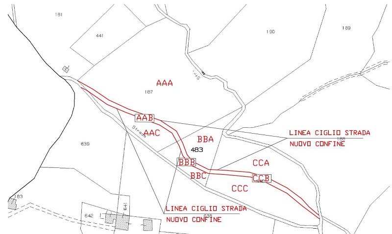
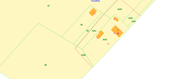
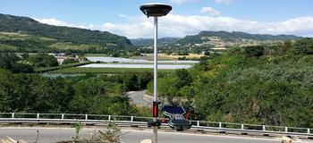
Special: MyGeo Solution
We divide and reposition surfaces and cadastral boundaries in order to give feedback to the client of any historical and / or current change on their properties, we update the cadastral maps with precision measurements. We reposition historical boundaries using updated techniques crossed with historical data.

Get a quote

@

I have read and agree to the Privacy Policy

I would like to stay updated on technical and commercial news.

Could be interesting to you