We carry out
monitoring and surveys aimed at controlling morphological variations for the study and realization of
hydraulic settling.
This allows data to be realized and processed in order to acquire a historical set of information that can be used in the different phases of programming life.
The service offered can be realized with high
precision technologies, for exaple
GNSS and/or
drone based on how you choose data return.
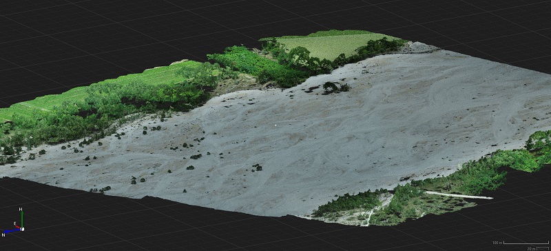
The use of the
Drone allows to have two types of data return:
- Return of data in orthophoto (geometrically correct aerial photography and georeferenced) for the state of fact updated following specific events
- Return with cloud of points; as methodology is carried out a three-dimensional modeling for design to remove inert data or a modeling for sections, segmenting the river into several parts.
The use of
GNSS allows to have the following data return:
- Return of three-dimensional data with point cloud; the use of this instrument is predefined to insert and/or update data in the document Project Review Meeting or to perform a massive survey.
This instrument can also be used as an
integration and
support to the drone during the execution of the work.