Special: MyGeo Solution
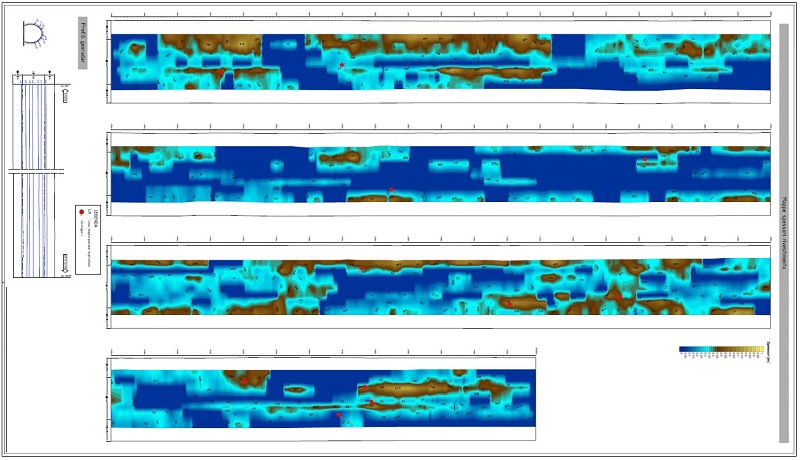
We operate in the thematic areas of geomatics applied to railway structures: we deal specifically with georeferencing, surveying and controlling, processing and returning complex metric and / or thematic data with spatial-temporal reference and non-destructive controls. With the use of laser scanner, georadar and photogrammetry scans, in addition to traditional topographic surveys, we detect and calculate potential interferences present along the railway line and evaluate the variations of the dielectric constant of the investigated materials with the reflection technique.