We offer our clients the possibility of free navigation directly on the model with direct measurement.
We provide the customer who rewards us with trust, a free and simple view of the final model of relief usable through a fully free three-dimensional data viewer.
The possibilities are:
- measuring and navigating the cloud of generated points which can be used directly from your computer workstation;
- perform direct measurements on the model of the "point cloud"
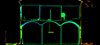
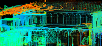
Historic building point cloud model

