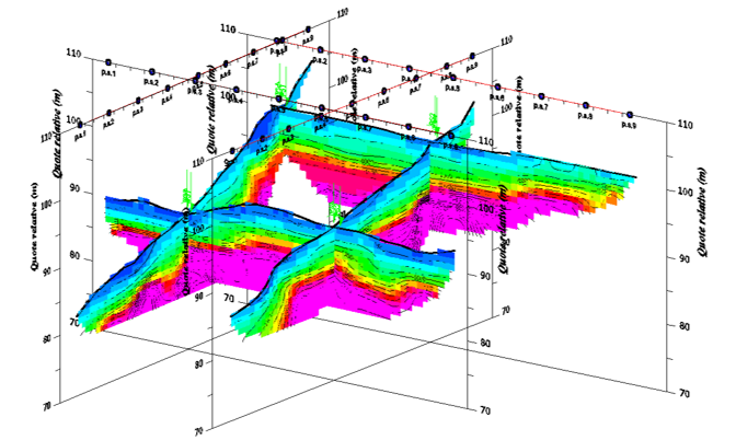
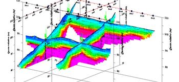
We carry out seismic investigations in the non-visible area with non-destructive tests, structural reconstructions of the subsoil, identification of mineral resources, definition of landslides, determination of dynamic elastic modules and attribution of the Vs30 category according to anti-seismic regulations.
The technique we use, called seismic tomography, is a seismic investigation technique based on the analysis of the speed of propagation of seismic waves in the subsoil by artificial or natural stresses.
We carry out seismic investigations in the non-visible area with non-destructive tests,
structural reconstructions of the subsoil, identification of mineral resources, definition of landslides, determination of dynamic elastic modules and attribution of the Vs30 category according to anti-seismic regulations.
The technique we use, called seismic tomography, is a seismic investigation technique based on the analysis of the speed of propagation of
seismic waves in the subsoil by artificial or natural stresses.