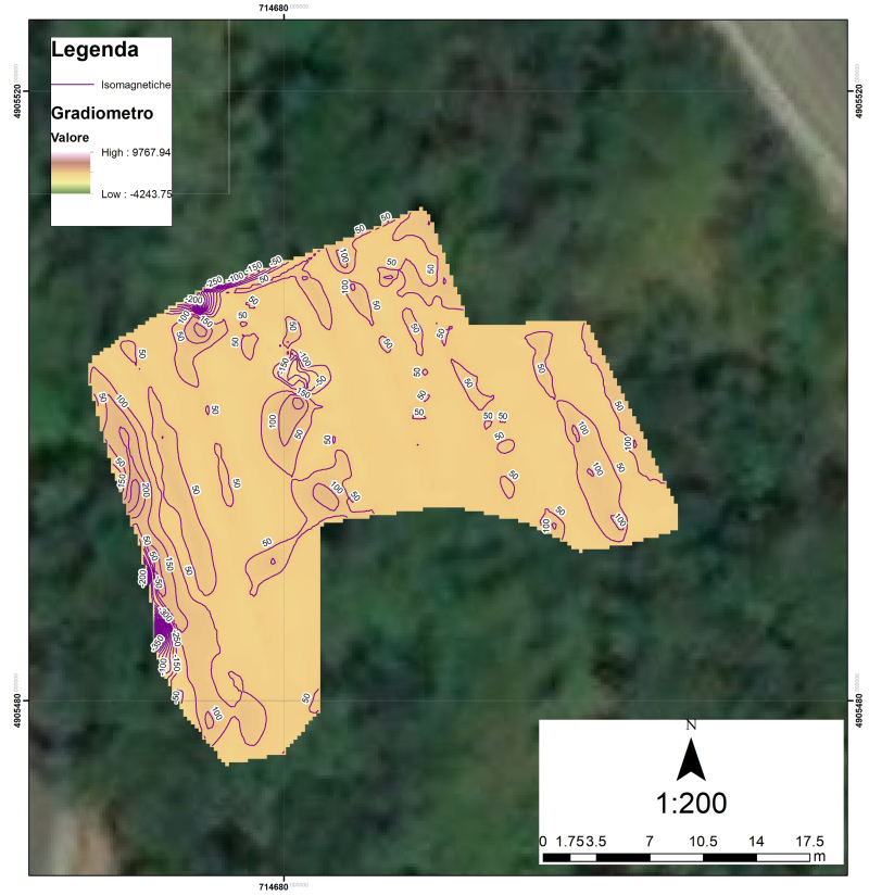
We carry out investigations in order to identify anomalous behaviors of the earth's magnetic field, caused by the presence of buried bodies or structures, in particular of metallic material.
The main use of the magnetometry technique is to identify and map the presence of any war and / or metallic bane anomalies, the main investigation areas have objective and physical difficulties (eg terrain acclivities, landslide risks or landslides) for the which georadar surveys are not possible.
We operate in this sector with certified mountaineering equipment.
We carry out surveys for mountain communities, planning and first aid institutions and fire departments.
We carry out investigations in order to identify anomalous behaviors of the earth's magnetic field, caused by the presence of
buried bodies or structures, in particular of metallic material.
The main use of the magnetometry technique is to identify and
map the presence of any war and / or metallic bane anomalies, the main investigation areas have objective and physical difficulties (eg terrain acclivities, landslide risks or landslides) for the which
georadar surveys are not possible.
We operate in this sector with certified mountaineering equipment.We carry out surveys for local administrative bodies and regulatory agencies, planning and first aid institutions and fire departments.