22 February 2019
Building site
surveys were carried out following construction of
work activities in the construction field.
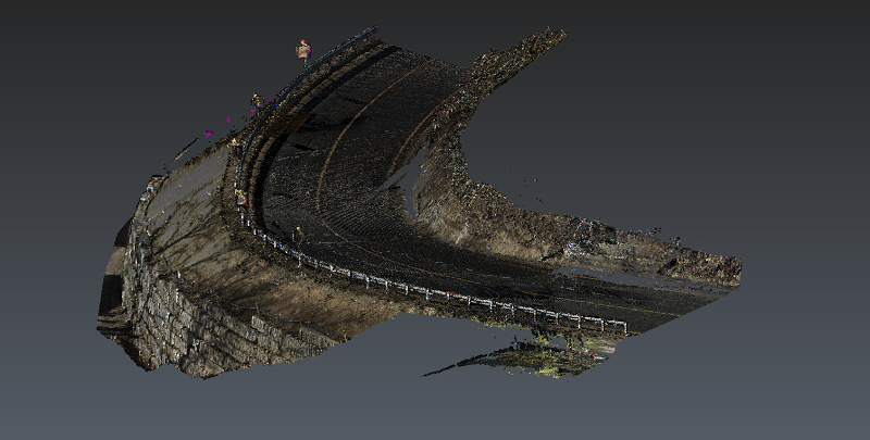
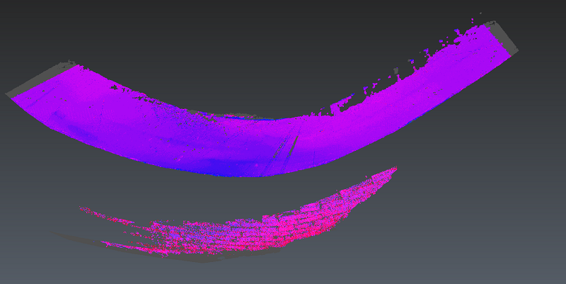
The scope of the assignment consisted in
monitoring and controlling the variations of the yards and the constructions in development, through peridic scans with instrumentation to high technological value.
- Project: Monitoring for the safety of construction sites
- Client: Direct client
- Monitoring period: 2017 - 2019 L
- Locality: Casola Valsenio (RA)
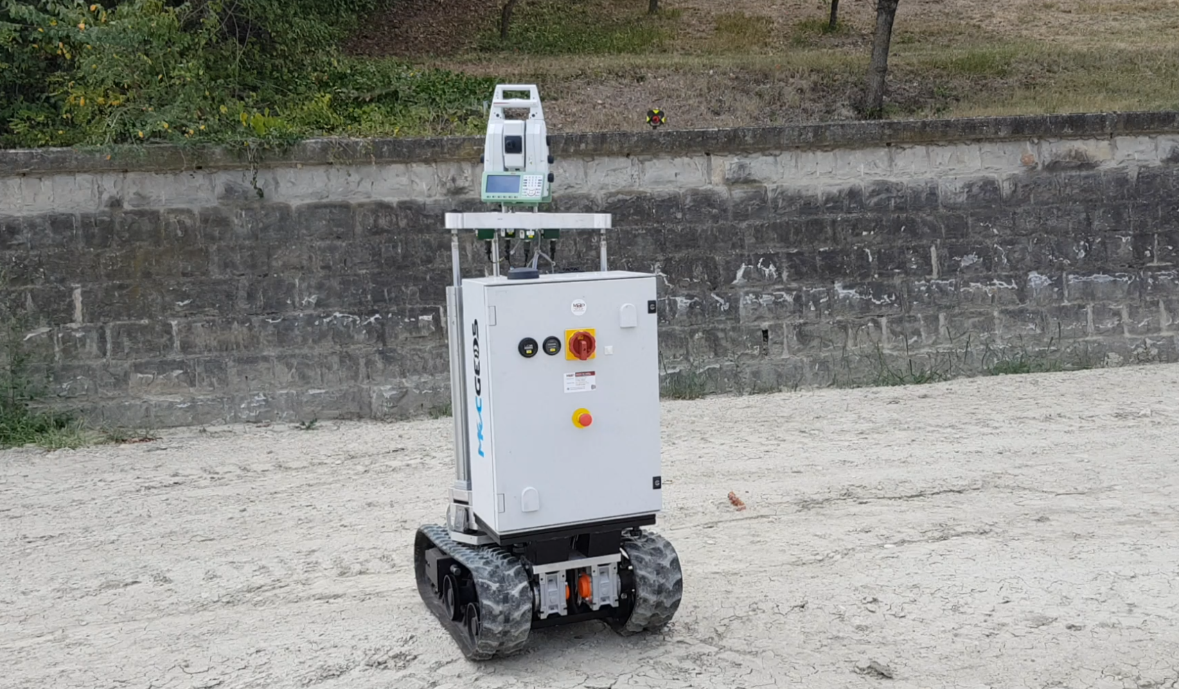
The following equipment was used for the execution of the work:
- MecGeos Remote Control
- Laser Scanner P30 Leica-Geosystems
The following software was used to process the work:
- Cyclone Leica Geosystems
- 3DReshaper Hexagon
Geosolvo® Solutions
- Robot MecGeos V1 to automate 3D survey