16 June 2022
Thermographic surveys were carried out of
the cover of a non-hazardous waste landfill following episodes of the self-grafting principle and the presence of smoke and burning odor.
The survey took place by
APR and thermal chamber at a height of 60 meters for the entire area of 24 hectares and 30 meters for the provinces of most significant interest.
The flight was
performed at night in order to limit the interference of the sun and in the winter month of late January where the
average surface temperature was about zero degrees.
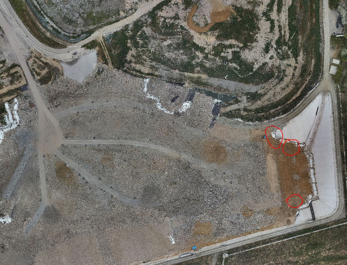
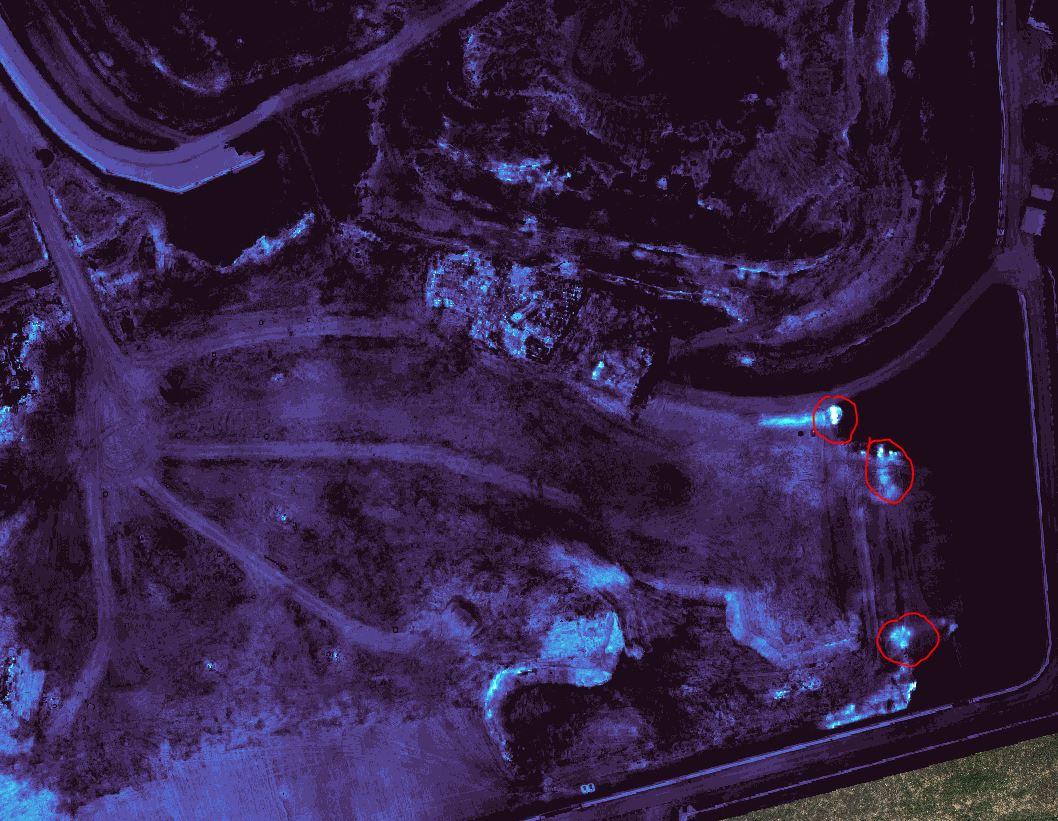
The purpose of the assignment was
to highlight the areas with higher surface temperatures around 20/25 degrees through
the overlap of the RGB image obtained with diurnal flight and both the
thermal image obtained at night and
classifying the colors of the results.
The areas highlighted in red reported by our survey were
inspected by the client through on-site surveys that showed temperatures above 0 degrees at a depth of about one meter and adopted the appropriate strategies to control the areas indicated.
- Project: infrared thermal imaging
- Client: Direct Company
- Place: national territory
For the execution of the work used the following instrumentation:
- Matrice 300 with Zenmuse H20T camera
For the elaboration of the work the programs were used: